Flood dentention dams will have a dual purpose of recharging the groundwater as well as would reduce the flood velocity, and there will be fewer losses to the fertile soil erosion, habitat destructions, and public amenities like link roads, electricity poles, and local human settlements says experts
By Rehan Khan Khushik
KARACHI/HYDERABAD. World Bank Technical mission for Sindh Flood Emergency Rehabilition Project Irrigation Component comprised on Mr Ahsan Tehsin Senior Disaster Risk Managent specialist and Task Team leader,
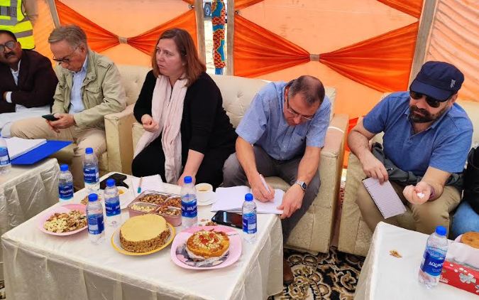
Ms Amparo Samper Hiraldo senior Disaster Risk Management Specialist , Mr Alessandro Palmieri consultant, Mr Jaun Soler Cabado consultant Mr Hendrik Arnold Vernoon Consultant, Mr Bilal Khalid Disaster Risk Management specialist , Aijaz Shaikh Consultant visited three flood dention dams constructed by Sindh Flood Emergency Rehabilition Project Funded by World Bank at lat basin located near Gadap town Malir in Kohistan region of Sindh..
While briefing the mission, Zahid Shaikh senior water resource management specialist SFERP said that SFERP’s Irrigation component has constructed the total of eleven flood detention small dams.
He said that Seven dams are located at Mole Basin and four dams at Lat Basin.
He said that all streams are non-perennial and water is available mostly during the monsoon season.
He said that these dams will have a dual purpose of recharging the groundwater as well as would reduce the flood velocity, and there will be fewer losses to the fertile soil erosion, habitat destructions, and public amenities like link roads, electricity poles, and local human settlements. “Due to the project, intervention water will be available for a longer period, which will augment to uplift socio-economic activities” they added.
While SFERP was represented by Aqil Memon additional director, Zahid Shaikh senior water resource management specialist, Naeem Arif from Project and Mohammad Nawaz Soomro from project implemention consultance, Nasir Panhwar social safe guard consultant and Marvi Baloch gender specialist during the visit.
Mr Naeem Arif the project consultant brief the WB technical mission about the Lat-1 Dam that the design discharge cusecs of lat-1 flood dentetion dam is 16570 cusecs , storage capacity area is 56 acres, ebmankment length is 4830 feet, reservior storage capacity is 364 acres, width spilway is 525 foot, floor level is 524 foot , highest flood level is 546 foot , embankment top level is 550 foot , spilway highest is 18 foot, embankment highest above river bed is 26 foot.
During the visit at lat -2 Dam site, Mohammad Nawaz Soomro briefed WB technical team said that the commencement date is of the lat-2 dam is 20 march 2023 and comoletion date 18 march 2024.
He said that the catchment area of the dam is 5 squire miles. He said that the spilway type is ogee stepped spilway.
He said that the design discharge of the dam is 9120 cusecs , width of spilway feet 299 feet, Floor level 506 feet, spilway crest level 522 feet, heighest flood level 526 feet, embankment Top level 530 feet,
He said that spilway height 16 feet, head above crest 4 feet, free board 4 feet, embankment height above the river bed 24 feet, embankment type is earthfill. He said that embankment length 2.701 feet, storage area 26 acres and Reservior storage acres 113.
During visit at Lat -3 dam, Aqeel Memon additional director SFERP said that Latitude Commencement date of this flood dentition dam is 30 march 2023 and planned completion date 28 march 2024..
He said that the catchment area is 29 squire miles, spilway is Ogee sleeped spilway, design discharge 21.172 cusecs.
He said that width of spilway 480 feet, floor level 416 feet, hiegest flood level 431 feet , embankment top level 436 feet, spilway height 10 feet, head above crest 5 feet, free board 4 feet, embankment height above river bed 19 feet, embankment type earth, embankment length 4,434 feet, storage area acres 29 and reservior storage acres 101 feet.
Nasir Ali Panhwar, Social Safeguard Specialist said the local population in project areas are using subsurface and groundwater for consumption. The groundwater depth varies from 150 to 300 ft. in different parts of the Kohistan region. The distance traveled by women to fetch water varies from area to area for instance, in Kohistan, they travel about two to three kilometers distance per trip. “The dams will help in recharging the groundwater and provide water in the areas where it is crucial for drinking, domestic use, and livestock, he added.


